The story of October 31st 1415 is well known to us all.
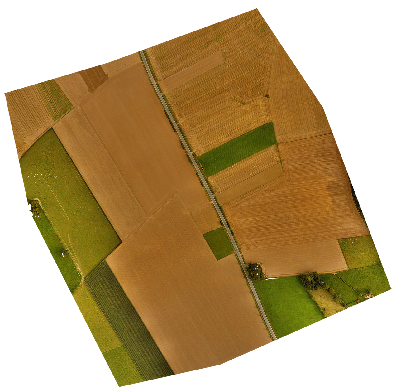
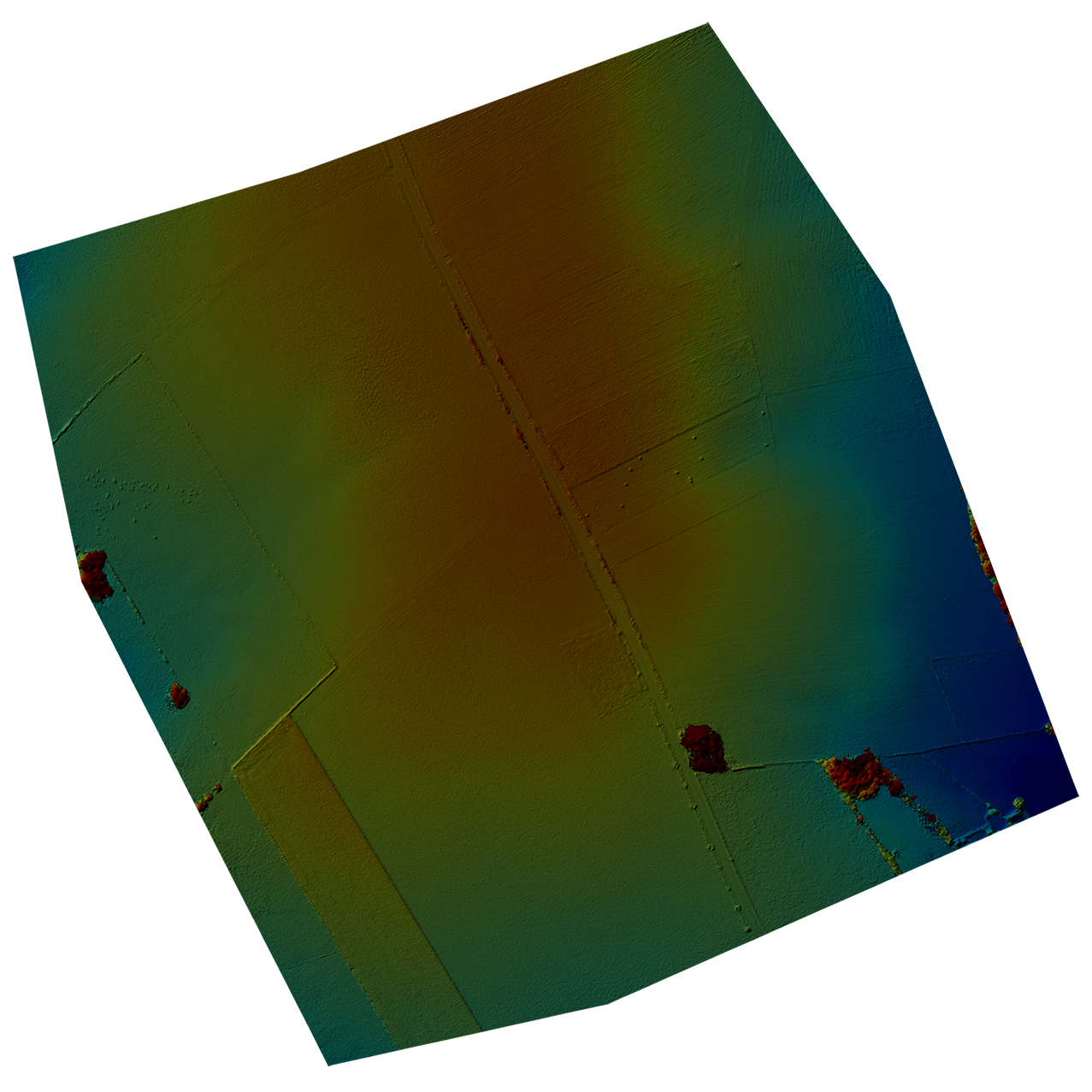
This survey was carried out to examine the logic behind Henry V's last minute decision to move his archers from the line of the road (running E-W in these shots at he south of the site) to a point 400 yards further north.
It can clearly be seen that Henry, despite the risk, regarded that the position northwards was advantageous, probably due to the slight but significant rise towards the center of the site, as indicated by the red elevation values.
The funnel effect caused by the forests that grew right and left of the survey area forced the French knights into a killing field where they were mercilessly slaughtered by the weakened and starving tiny English army, who produced one of the most remarkable victories of the hundred years war and led to the french king declaring Henry of England his heir.
|
|
