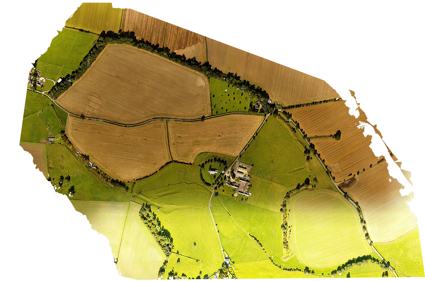
Stanwick Iron Age settlement gets its fame from the massive and complex multiphased iron age earthworks surrounding the tiny village of Aldborough St. John
Well worth a visit, the fortifications are in places still substantial enough to give a general idea of the time and effort required to construct.
Whist opinion is still divided as to the reason and function of the earthworks they are acknowledged generally to be one of the tribal centers of the Brigantes tribe, whos territory appears to cover substantial parts of what we now call North Yorkshire.
The earthworks have been excavated by the famous Mortimer Wheeler, and a section of "reconstructed" earthwork is available to visit.
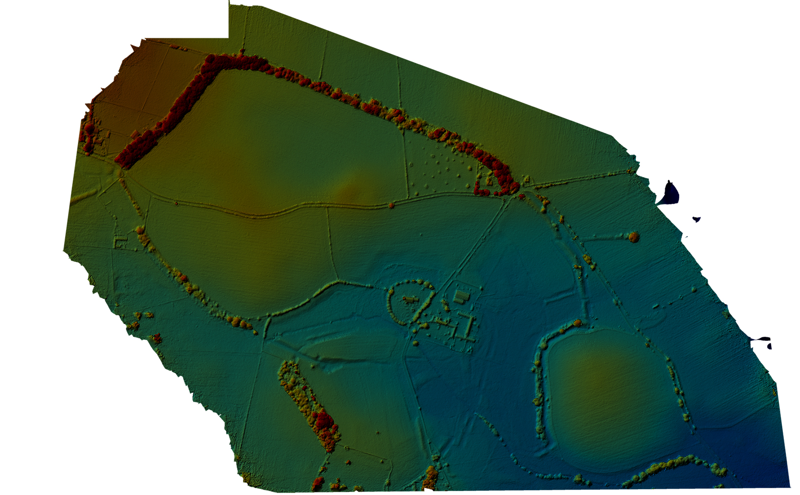
The ground mapping process reveals the track of the earthworks and the huge effort and social control that their construction required, but sadly brings us no closer to guessing their function.
Well worth a visit, the fortifications are in places still substantial enough to give a general idea of the time and effort required to construct.
Whist opinion is still divided as to the reason and function of the earthworks they are acknowledged generally to be one of the tribal centers of the Brigantes tribe, whos territory appears to cover substantial parts of what we now call North Yorkshire.
The earthworks have been excavated by the famous Mortimer Wheeler, and a section of "reconstructed" earthwork is available to visit.
The ground mapping process reveals the track of the earthworks and the huge effort and social control that their construction required, but sadly brings us no closer to guessing their function.
|
|
